Unmanned Aerial Services

Aircraft
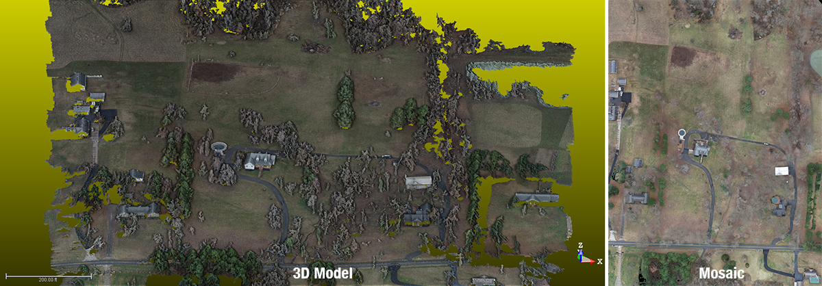
BFW uses the WingtraOne GEN II dual rotor VTOL drone for data capture. The WingtraOne GEN II is one of the most exclusive fixed wing mapping drones in the industry. The aircraft has an operating range of 4 miles. With a flight time of over an hour, we can capture over 400 acres in one flight. The 42-megapixel Sony RX1 camera produces crystal clear images allowing our software program to stitch each picture into a single gigapixel image flawlessly.
Processing Software
BFW owns a full licensed seat of the industry standard Pix4D Mapper software that we utilize to process and deliver our data sets. Typical deliverable formats include full-color point clouds, digital surface models, and 3D textured mesh files all of which can be utilized in the common AutoCAD software suites (File types: .las, .laz, .ply, .xyz, .tif, .kml, .shp, .dxf, .pdf).
Pilots
BFW employs 4 full-time FAA Certified Part 107 Remote Pilots that are professionally trained and certified to fly and provide survey grade ground control on the projects. Any aerial data we collect can be field validated and ground proofed with the same confidence level of traditional topographic survey procedures.