Wingo Interchange – I-69 Corridor

Mobil LiDAR Survey
Bacon Farmer Workman (BFW) was entrusted with the Wingo Interchange – I-69 Corridor project. To complete the project, BFW provided a complete geometric layout sheet for KYTC and FHWA approvals for existing service interchanges at US 51 and KY 307 and Exit 14 per the I 69 conversion agreement. The project also included:
- Removal of the existing rolled curbs within the interstate’s operational area
- Replacement of rolled curbs with adequate shoulders
- Reconstruction of Exit 14
- Correct two substandard vertical clearances by adjusting and lowering mainlines
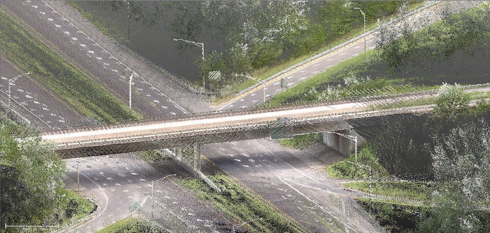
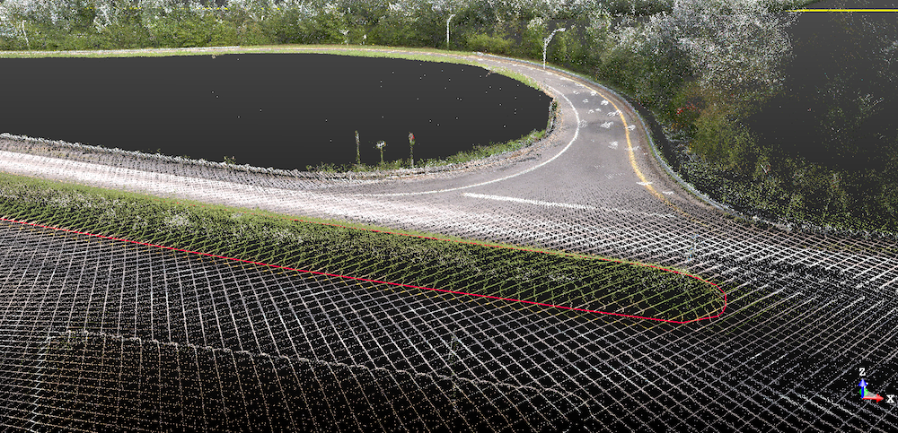
In addition, BFW provided the Mobile LiDAR scanning by vehicle on 3 miles of interstate and ramp for redesign of on/off ramp. The bridge clearance model was created at 5’ by 5’ increments with lows and highs report as well as an exported drawing for Microstation (Geopak), and a light pole and guardrail inventory was created across the site with number of poles and length of guardrail. Both the 4-lane interstate and bridge crossing had features extracted such as:
- 4-lane Interstate:
- Centerline
- Edge of pavement
- Ramp break lines
- Lane lines
- Crown
- Paved/gravel shoulder
- Center of median
- Bridge Crossing:
- Pier edge
- Abutment
- Columns
- Rails
- Attached signs
BFW is proud to have delivered a survey to aid in the planning of the upgrade and increased safety of the Wingo Interchange – I-69 Corridor.